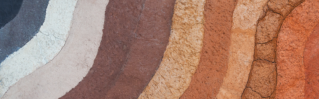
Did you know that soils are classified into taxonomic groups? The soil classification system is similar to the way that living organisms, including plants and animals, are classified into groups based on physical, chemical and morphological properties. Soil scientists classify soils into hierarchical taxonomic categories including order, suborder, great group, subgroup, family and series. The broadest category is the soil order. (View a high resolution poster of the twelve orders of soil.) The smallest unit is the series, which is akin to the species level of plant and animal taxonomic classification. The soil taxonomy system used in the United States was primarily developed by the United States Department of Agriculture (USDA).
New Jersey has 195 named soil series within our state, out of the 20,000 detailed soil series covering the United States, Territories, Commonwealths and Island Nations served by USDA-NRCS. The soil properties that help to determine a soil’s classification include, soil horizons (layers), texture, structure, moisture regime, pH, color, organic matter content, and others. Using these characteristics, soil scientists describe and classify soils for various applications that range from agriculture, forestry, land use planning and environmental impact management.
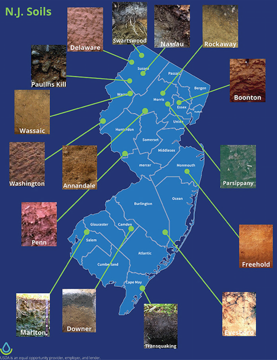
As shown on the map, NJ soil series include Nassau, Rockaway, Parsippany, Freehold, and Marlton. You may recognize these soil series names as names of familiar towns and cities. A soil series name is generally derived from a town or landmark near the area where the soil series was first recognized. Our state soil series is called Downer. In 1955, a soil scientist by the name of G. A. Quackenbush of the New Jersey Agricultural Experiment Station was the first to use the name Downer to represent some yellowish, sandy, droughty soils of the Pine Barrens.
Other soils commonly found in Ocean County’s coastal plain region include Atsion, Lakehurst, Woodmansie, Berryland and Manahawkin. Atsion, Lakehurst, Woodmansie and Berryland primarily contain mineral content whose parent material consists of one or more: windblown sand (eolian) deposits, river and/or marine (fluviomarine) sediments. A profile of Woodmansie sand is described in the image. The profile shows the stark and beautiful color differences among the horizons. Woodmansie is classified in the soil order Ultisols.
Horizon A:
- Depth: 0-2 inches
- Texture: sand (fine, rounded quartz)
- Structure: single grain
- Color: dark gray (N 4/0)
- pH: very strongly acidic
Horizon E:
- Depth: 2-8 inches
- Texture: sand (fine, rounded quartzose)
- Structure: single grain
- Color: gray (10 YR 6/1)
- pH: very strongly acidic
Horizon BE (This transition layer is not shown):
- Depth: 8-17 inches
- Texture: sand (round quartzose)
- Structure: single grain
- Color: light yellowish brown (10 YR 5/6)
- pH: very strongly acidic
Horizon Bt:
- Depth: 17-30 inches
- Texture: sandy loam (fine and course rounded quartzose)
- Structure: fine and medium subangular, blocky
- Color: yellowish brown (10 YR 5/6)
- pH: very strongly acidic
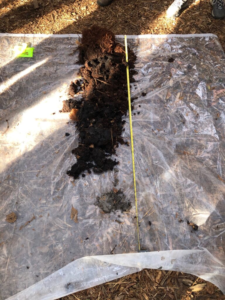
Manahawkin is classified as a “muck”, and is within the soil order Histosols. It is primarily composed of organic deposits underlain by fluviomarine sediments. A typical profile of Manahawkin muck consists of 4 O horizons (Oa1, Oa2, Oa3, Oa4), all containing organic matter in varying stages of decomposition. A profile of Manahawkin muck is described in the image. Oa1 is a fibrous root mat with many fine rootlets, mixed with decomposing and decomposed organic matter. Oa2 and Oa3 contain medium and fine roots, as well as decomposed and decomposing organic matter. Oa4 has a structure referred to as “massive”, which means the soil has a large, solid, featureless mass of decomposed organic matter. It feels smooth and squishy to the touch. The sample of Manahawkin muck shown in the image is the foundation of an Atlantic White Cedar forest.
Horizon Oa1:
- Depth: 0-8 inches
- Texture: broken face and rubbed muck
- Structure: mat of many fine roots; identifiable material is primarily herbaceous with a trace of woody fragments
- Color: black (5YR 2/1)
- pH: extremely acidic
Horizon Oa2 and Oa3:
- Depth: 8-30 inches
- Texture: broken face and rubbed muck
- Structure: fine and medium roots; organic matter and soft woody fragments
- Color: black (5YR 2/1)
- pH: very strongly acidic
Horizon Oa4:
- Depth: 30-39 inches
- Texture: broken face and rubbed muck
- Structure: massive; mostly organic matter
- Color: black (5YR 2/1)
- pH: very strongly acidic
Horizon Cg1:
- Depth: 39-46 inches
- Texture: sand
- Structure: single grain loose
- Color: gray (10YR 5/1)
- pH:strongly acidic
How can you determine which soil series is underfoot? Handy tools include Web Soil Survey and Soil Web. Web Soil Survey is operated by USDA-NRCS and uses soil data collected and produced by the National Cooperative Soil Survey. Soil Web was developed by the California Soil Resource Lab in collaboration with USDA-NRCS. Web Soil Survey and Soil Web are accessible on your desktop or mobile device. Both provide interactive maps that allow you to explore soil survey data throughout the United States. Additional tools can be found on the USDA-NRCS Soils Tools webpage. And of course, visit the Ocean County Soil Conservation District’s soil resources webpages for additional information about all things “soil”!