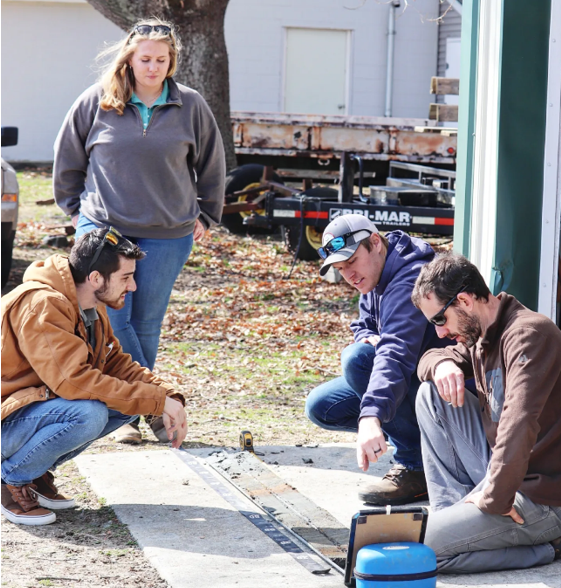
In February, District staff members Ben Hayden, Rachel Hammack and Kristin Adams assisted USDA-NRCS Soil Scientists David Steinmann and Adam DeWolfe with describing and analyzing subaqueous soil samples. Rachel and Kristin helped retrieve the samples, or cores as they are called, from the Great Bay this past fall. After the cores were taken, they were moved to a refrigerator unit until analysis to help preserve the integrity of the samples and slow down any chemical processes that will change the chemistry and composure of the soils.
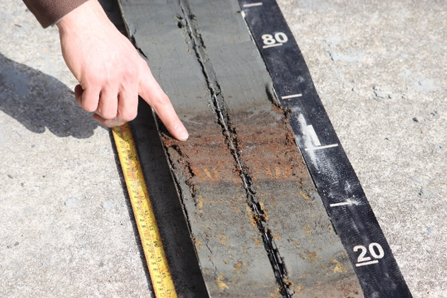
After the cores are cut open and split into two halves, they are divided into different soil horizons or layers based on physical (texture, color, % shell fragments, etc.) or chemical differences (pH, presence of sulfidic materials, etc.). In the photo on the left, the red/orange color of the soil is organic soil material, in this case plant roots developed in terrestrial tidal marsh that have been buried and preserved for perhaps hundreds of years. After the horizons are marked out, they are each measured for depth and assigned a color using the Munsell color chart. Next, each horizon is given a USDA texture class based off the soil properties, such as a loamy fine sand or a silty clay loam as pictured here. Texture is determined using a ribbon test, if the sample is gritty or smooth, how well the sample holds together in a ball, how sticky it is and a fluidity test that all help scientists determine the percent of sand, silt, and clay in each sample.
Other analysis is performed including an odor test, pH test, degree or decomposition for organic horizons, and peroxide test, using 3% and 30% hydrogen peroxide solutions to determine the presence of sulfidic materials. The presence of shell fragments, roots, or any other buried materials are also noted in the description. The two cores that were analyzed are associated with two different landforms: a wash over sand flat, which consists mostly of sandy material from the barrier island washed over and deposited directly behind the barrier island due to strong storm events and submerged wave-cut platforms/eroded marshes, which are associated with wave eroded marsh edges that typically have more silt and clay properties (muddy). These often have organic soil materials sequestered (buried) in the soil profile and are therefore a very important blue carbon sink.
After the analysis is complete and the core has been fully described, the characteristics are used to classify the soil and determine the soil series. The soils described and data collected will then be used to develop soil map units in the new subaqueous soil survey. Each soil series and mapping unit contains its own set of information, and once interpreted is available for viewing on Web Soil Survey. New Coastal Zone interpretations available on Web Soil Survey include suitability for Eastern Oyster Habitat Restoration, Eelgrass Restoration, Hard Clam Habitat, CMECS substrate classes, and Land Utilization of Dredged Materials, with many more coming soon.