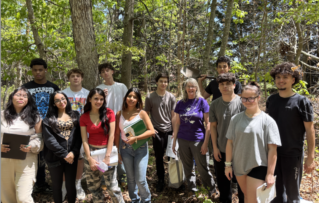
The soil beneath our feet is more than just dirt—it’s a complex, living system that supports ecosystems, sustains agriculture, and records Earth’s history. Lacey Township High School students in Mr. Conklin and Ms. Audet’s science classes recently discovered just how dynamic and important soil is, thanks to a two-day outreach program led by Becky Laboy, Education Outreach Coordinator with the Ocean County Soil Conservation District (OCSCD).
Over the course of the program, students engaged in hands-on science, digging into the Downer soil series, a common soil type in New Jersey, right on their school campus. The experience brought textbook concepts to life, from the physical acts of examining soil horizons and conducting particle size analysis, to learning how soil connects to broader ecological and historical topics.
Uncovering the Science of Soil
Ms. Laboy introduced students to the five soil-forming factors known as CLORPT:
- Climate influences temperature and precipitation, shaping how soils develop.
- Organisms, like plants, fungi, bacteria, and animals, contribute organic matter and help mix soil layers.
- Relief and Topography – the slope, elevation, and position on the landscape affect drainage and erosion.
- Parent Material is the original geological material (like sand, silt, or clay) from which the soil is formed.
- Time allows all these factors to interact and transform material into mature soil profiles.
Using this framework, students explored how local environmental conditions have shaped the Downer series over thousands of years.
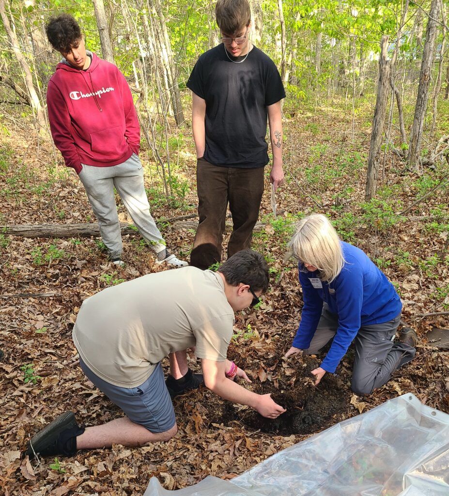
With shovel in hand, students headed outdoors to a wooded area on the Lacey Township High School campus – an ideal natural classroom. Their first task was to observe the leaf litter blanketing the forest floor. As they examined the layer of fallen leaves and organic debris, they began identifying the plant species that made up the surrounding vegetative community, including familiar native species like oak (Quercus sp.), sassafras (Sassafras sp.), and huckleberry (Vaccinium sp.).
Among the low shrubs, students spotted spiders nestled in delicate webs, an up-close reminder of the forest’s biodiversity. Overhead, the woods echoed with bird calls. Ms. Laboy paused to identify several bird species by their songs, sharing fascinating details about how these birds rely on native plants for food and shelter. Through these real-time observations, students began to understand how soil supports plant life, which in turn supports a web of wildlife—from insects to birds and beyond. By understanding the link between soil and biodiversity, students gained insight into why preserving native soils and vegetation is vital for ecosystem resilience.
After immersing themselves in the sights and sounds of the ecosystem, students turned their attention to what lay beneath their feet. They carefully began digging into the soil, exposing the hidden layers below—and opening the door to a deeper understanding of soil horizons.
Horizons: Layers That Tell a Story
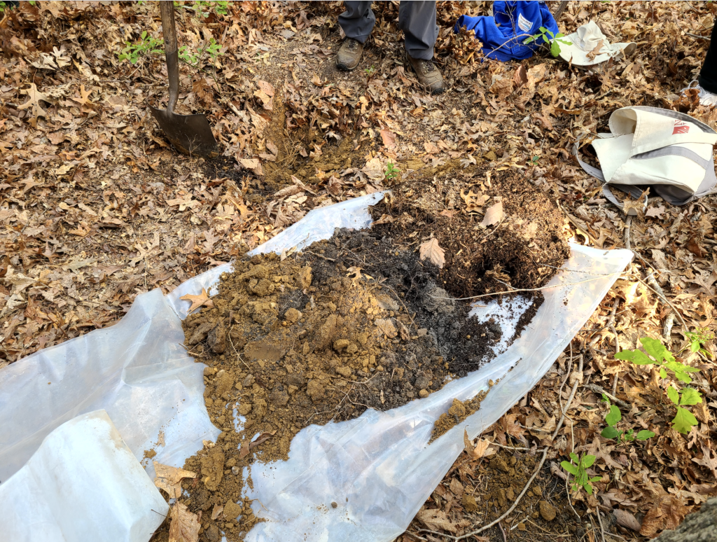
One of the most fascinating parts of the experience was examining soil horizons—the distinct layers of soil that develop over time through natural processes of weathering, organic matter accumulation, leaching, and biological activity. These horizons form a vertical profile, and each one tells a unique story about the environment, offering clues about the history of the land, and the soil’s formation and function. Students dug into the Downer soil series and identified several key horizons: the rich organic top layer (O horizon), the mineral-rich A horizon, and the subsoil B horizon.
O Horizon (Organic Layer): This topmost layer is composed mainly of decomposed leaves, twigs, and other plant material. It’s rich in organic matter and teeming with microbial life, serving as nature’s recycling zone. Not all soils have a well-developed O horizon, especially in areas with low vegetation, but where it exists, it’s critical for nutrient cycling.
A Horizon (Topsoil): Just beneath the organic layer is the A horizon, commonly known as topsoil. This is a dark, mineral-rich layer where plant roots are most active. It contains a mixture of organic material and minerals and is vital for plant growth. This layer is often the focus of agriculture and gardening because of its fertility.
B Horizon (Subsoil): Below the topsoil lies the B horizon, or subsoil, where materials like iron, clay, aluminum, and organic compounds accumulate—a process known as illuviation. This layer often has a denser, more compact structure and can vary in color depending on the materials present. The B horizon plays an important role in water retention and nutrient storage.
While students were able to observe the O, A, and B horizons in their soil pit, they also learned about additional layers—the E, C and R horizons that were not immediately visible:
E Horizon (Eluviation Layer): Although not observed in our Downer series, in some soil types there’s a light-colored E horizon beneath the A horizon. It’s characterized by the eluviation (leaching out) of silicate clay, iron, or aluminum. Although not always present, this layer indicates heavy water movement that has washed certain minerals downward.
C Horizon (Parent Material): This layer consists of weathered pieces of rock and partially disintegrated material from which the soil above has developed. It is much less affected by biological activity and weathering and serves as the transition zone between true soil and the unweathered rock below.
R Horizon (Bedrock): While not typically reached during classroom digs, the R horizon lies beneath all other layers and consists of unweathered bedrock. It’s the ultimate parent material from which soils eventually form, given enough time.
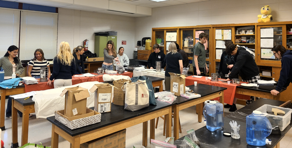
Texture: The Building Blocks of Soil
Back in the classroom, in a soil lab activity, students conducted a particle size analysis using soil sieves—a classic method for exploring soil texture, which refers to the relative proportions of sand, silt, and clay in a soil sample. Soil texture is one of the most important physical properties of soil because it influences how well the soil holds water, drains, and provides space for roots and soil organisms.

Each component has distinct characteristics:
- Sand particles are the largest and feel gritty. They create spaces in the soil that allow for good drainage and air flow, but they don’t hold on to nutrients well.
- Silt particles are medium-sized and feel smooth or silky. They retain more moisture than sand and help soil hold nutrients.
- Clay particles are the smallest and feel sticky when wet. Clay holds water and nutrients tightly but can make soil dense and slow to drain.
Loam is a balanced soil texture made up of roughly 40% sand, 40% silt, and 20% clay. It combines the best qualities of each particle size—good drainage from sand, moisture retention from silt, and nutrient-holding capacity from clay—making it ideal for plant growth and often referred to as the “gold standard” of garden soils.
However, students also learned that native plant species don’t necessarily require loam to thrive. In fact, they are specially adapted to grow in the native soils of their region—like the Downer soil series at their school—where they’ve evolved to tolerate local conditions such as sandy textures, acidic pH, and low nutrient levels. This highlights the importance of preserving natural soil systems that support local ecosystems.
Using sieves of different mesh sizes, students separated their soil sample into these three major components: sand, silt and clay, and visually assessed the proportions. Then, applying what they had learned, they used a Soil Texture Triangle—a scientific tool that classifies soil based on particle percentages—to determine the soil texture class of their sample. This hands-on activity helped them understand how the mix of sand, silt, and clay determines a soil’s texture class—such as loamy sand, sandy clay, or silty loam—and how this texture affects the soil’s role in the ecosystem.
Learning from the Past: The Dust Bowl and Soil Conservation
To underscore the importance of protecting our soils, Ms. Laboy shared the story of the Dust Bowl—also known as the Dirty Thirties. In the 1930s, poor land management and prolonged drought turned vast areas of the American Midwest into dust storms, destroying farms and livelihoods.
In response to this environmental disaster, the U.S. government created the Soil Conservation Service in 1935 (now the Natural Resources Conservation Service, or NRCS), which eventually led to the formation of local Soil Conservation Districts across the country, including the Ocean County Soil Conservation District.
These agencies work to educate communities, promote sustainable land use, and implement conservation practices that protect soil health for future generations.
Digging Into the Future
The Lacey Township High School outreach program empowered students to become stewards of the land, giving them scientific knowledge, historical context, and ecological awareness. By literally and figuratively digging into the complexities of soil, they discovered how this essential resource connects the past, present, and future—from the roots of native plants to the wings of migrating birds, and from the depths of soil horizons to the soaring need for environmental responsibility.
As Ms. Laboy reminded the students, “Healthy soil supports healthy ecosystems—and understanding that is the first step toward protecting the natural world around us.”
If you’re interested in bringing a hands-on soil education program to your school or community group, contact Becky Laboy at education@soildistrict.org to learn more and schedule a visit!