When most people picture Ocean County, New Jersey, they imagine the boardwalk lights of Seaside Heights, the rolling surf at Island Beach State Park, or winding paddles through cedar-lined creeks in Double Trouble State Park. Whether driving through the suburbs of Toms River or exploring the quiet woods of Lacey Township, few associate this landscape with mining. After all, Ocean County lacks metallic ore or gemstones. What could possibly be worth digging up?
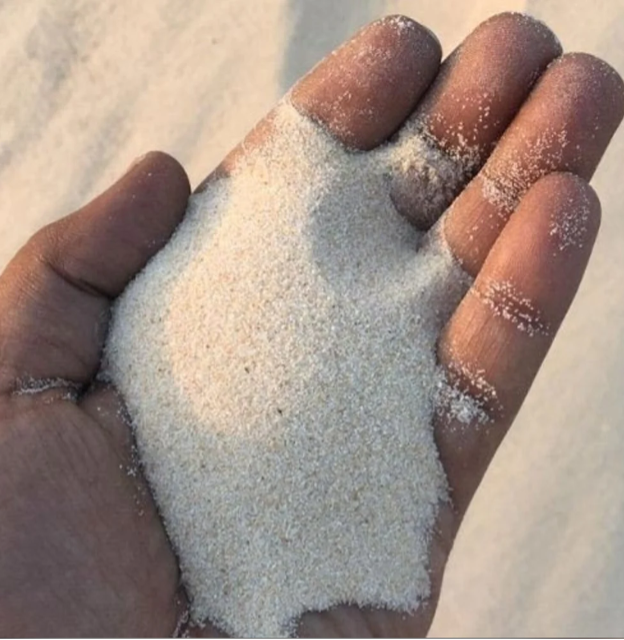
The answer is quartz sand. Pure, weathered, resilient, and deposited in vast quantities, this sand has become a key building block of modern infrastructure. Though often overlooked, mining in Ocean County is both economically significant and environmentally innovative. To understand why, we must first look beneath the surface and far into the past.
Ancient Origins
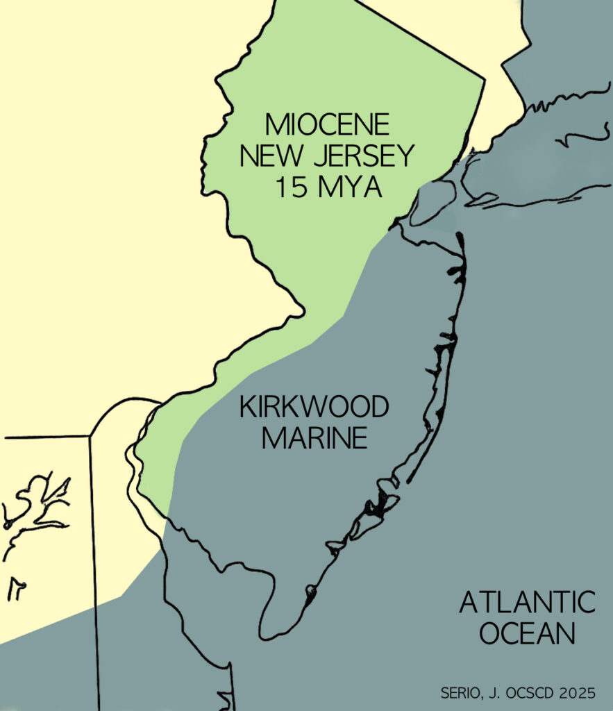
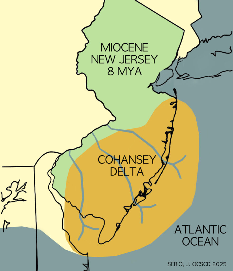
The story begins over 20 million years ago during the Miocene epoch. Over New Jersey’s coastal plain was shaped by rivers and seas that deposited sediments over countless generations. As the Appalachian Mountains slowly eroded, their sands and silts drifted eastward, settling into a landscape of shifting deltas, wetlands, estuaries, and barrier islands.
These environments evolved as sea levels rose and fell in response to global climate cycles. What we see today in Ocean County reflects the surface expression of that deep history.
The Kirkwood and Cohansey Formations
Ocean County sits atop two primary geologic units from the Miocene period: the Kirkwood Formation and the Cohansey Formation. These layers tell a story of changing environments. The older Kirkwood Formation consists of marine silts and clays deposited in offshore, prodelta settings when much of southern New Jersey was submerged. Over time, this was overlain by the younger, coarser Cohansey Formation, made up of quartz-rich sands deposited in beach and nearshore environments.
Together, these formations extend hundreds of feet underground and represent a wide range of depositional settings, from calm seafloor muds to high-energy coastal sands. These geologic layers also contain one of the most important groundwater sources on the East Coast: the Kirkwood-Cohansey aquifer. This vast freshwater reserve holds an estimated 17 trillion gallons of groundwater and plays a crucial role in supporting both human use and the surrounding Pine Barrens ecosystem.
A Natural Resource Shaped by Time
Although the stratigraphy is complex, the resource itself is straightforward. Sand from these formations is naturally sorted, chemically clean, and physically durable. These qualities make it especially valuable for construction, soil engineering, and stormwater management. Its utility lies not only in its abundance, but in the long geologic journey that refined it.
Pictured left is an outcrop exposure located on Route 9 in Toms River, NJ, illustrating a classic Miocene sequence of the Kirkwood–Cohansey transition. The basal layers (lower third) consist of fine to medium-grained, laminated sands likely representing marine shelf or offshore transition deposits of the lower Kirkwood Formation. Overlying these, the middle section displays better-sorted, light-colored, cross-bedded sands interpreted as fluvial to shoreface sediments of the upper Kirkwood Formation. The uppermost beds consist of oxidized, massive to cross-stratified quartz sands characteristic of the Cohansey Formation, reflecting progradational deltaic or barrier complex deposition under subaerial conditions. This upward-coarsening sequence represents a regressive systems tract across a transgressive–regressive boundary during the Miocene along the Atlantic Coastal Plain.
Mining Operations and Materials
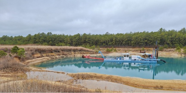
In Ocean County, companies like Clayton, Stavola and Silvi operate active sand mines using modern dredging techniques. Excavated material is screened and processed on site, with different grain sizes sorted for specific end uses. While the operation is technical, the outcome is essential to daily life.
These sands are used in an impressive range of applications. Concrete sand must meet precise engineering standards for use in foundations, bridges, and sidewalks. Asphalt sand becomes the base for highways and parking lots. Other specialty products include bunker sand for golf courses, root zone mixes for sports fields, and trench fill for utilities and stormwater systems. Even winter road treatments depend on coarse, weather-resistant sand.
The purity of these sands means they require less washing and processing. Their resistance to chemical weathering, a result of their quartz composition and the long journey from the Appalachians, makes them ideal for engineered soils and bioswale systems that need to remain porous and structurally sound under heavy rainfall.
Innovation Above and Below Ground
Ocean County’s mining operations are not only about removing material. Increasingly, they reflect a forward-thinking approach to land use and energy.
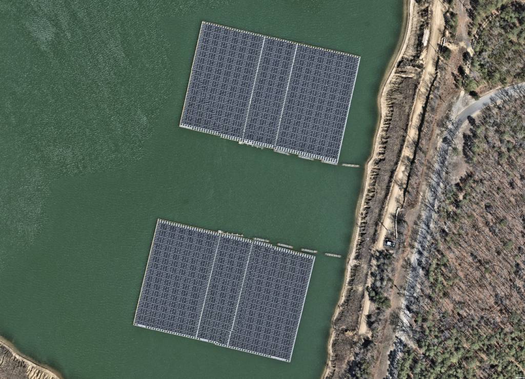
A standout example is the floating solar array at the Clayton Sand Company site in Jackson Township. Installed on a reclaimed dredge pond, the system includes more than 8,000 solar panels suspended on a flexible, interlocked platform that rises and falls with the water level. Anchored securely to the pond bottom and shoreline, this floating array generates clean electricity while leaving the land untouched. Maintenance is performed by boat, and energy output is monitored remotely.
Projects like this show how former extraction sites can be repurposed as assets for renewable energy and ecological balance. The mine’s surface becomes a platform for the future.
Partnerships in Land and Soil
Beyond infrastructure and innovation, these operations are deeply connected to local communities. Mining companies in Ocean County often collaborate with townships, school districts, and conservation agencies to support land management and environmental restoration.
A major focus is soil blending. By combining screened sand with compost and organic matter, these sites help produce engineered topsoils that meet the needs of stormwater retention basins, roadside stabilization projects, and athletic field construction. Mines also work with towns on composting initiatives, often serving as blending and curing stations for municipal yard waste programs.
Some mines even host experimental planting zones to test the performance of soil mixes under real conditions. Others support educational outreach, offering access to areas where students and scientists can study sediment layers, erosion control strategies, or groundwater recharge.
To support this work, operations follow strict best management practices. Stabilized access roads, wheel washes, dust suppression, and vegetative buffers are all part of a broader commitment to responsible land use.
Reclamation
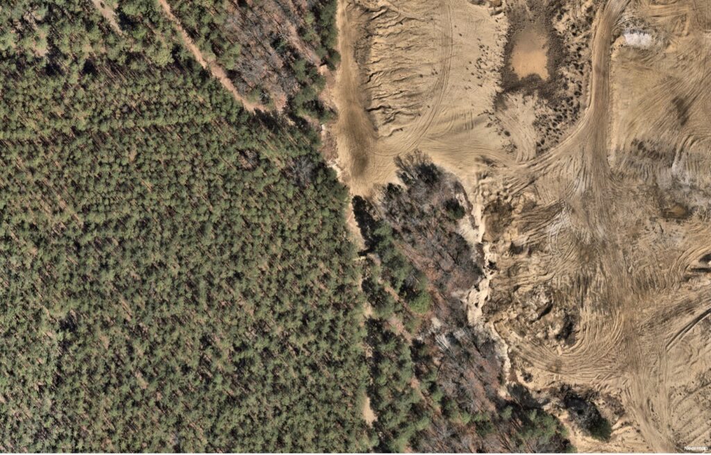
In Ocean County, reclamation is an essential part of the mining process. As each section of a site is completed, efforts begin to stabilize slopes, manage erosion, and restore natural landforms.
Where appropriate, native pine and oak trees are planted to reestablish forest cover and reconnect with surrounding habitats. These plantings help support local ecosystems, improve soil stability, and contribute to long-term environmental health.
Dredged ponds are often left in place and repurposed. Some serve as stormwater basins, while others, like those in Jackson Township, are used to host floating solar arrays that generate clean energy with minimal land impact.
All reclamation work follows strict State standards, but many companies in Ocean County go beyond the minimum. Aerial views of these sites often show newly reforested areas next to active operations, illustrating a clear transition from extraction to restoration.
Reclamation in Ocean County is not just about closing mines. It is about giving the land a new purpose and ensuring that what was once removed can support something lasting and beneficial.
Evolving Landscape
While most people associate Ocean County with its beaches and boardwalks, its mines tell a story just as connected to the region’s identity. From the Miocene sand formations laid down by ancient seas to the engineered soils that support today’s roads, parks, and buildings, this is a place where geology, history, and modern planning meet.
What begins as quartz grains formed over eons becomes the foundation for homes, highways, and public spaces. And as the landscape continues to evolve, these sites are showing how the legacy of extraction can support a future of energy, ecology, and community partnership.