USDA-NRCS Coastal Zone Soil Survey
Estuaries and shallow coastal waters are among the most productive habitats on earth, yet consistent and comprehensive baseline environmental data is generally lacking for these areas. Almost two-thirds of the world’s population lives in coastal areas, and it is estimated that 75% of the US population will do so in the next 25 years. An important data set is the soil / sediment type in the subaqueous and coastal area connecting the upland with the deep water environment (Payne, 2011).
The USDA Natural Resources Conservation Service (NRCS) Soil and Plant Science Division is responsible for surveying, mapping and interpreting soils throughout the country. Soil surveys have been produced for terrestrial lands since the early 1900s, a relatively new frontier in soil science and soil survey is Coastal Zone Soil Survey.
Coastal Zone Soil Survey focuses on soil mapping and soil data collection within the coastal zone which includes the dunes, marshes, beaches, anthropogenic coastal areas, and shallow (less than 5 meters of water depth) subaqueous soils. Completed Coastal Zone Soil Surveys assist coastal and estuarine managers by providing soil interpretations to determine the most suitable areas for restoration activities, assessing blue carbon sequestration potential, aquaculture, beach replenishment, etc.
All soil survey products, including Coastal Zone Soil Survey are published on Web Soil Survey.
A tidal marsh soil sample is retrieved using the McCauley Auger—photo by Kristin Adams
Tidal Marsh Soil Sampling for Coastal Blue Carbon
The USDA-NRCS Coastal Zone Soil Survey (CZSS) Team focuses its efforts on improving the soil survey within the coastal zone from New England to the Gulf Coast of Texas. The MLRA (Major Land Resource Area) Soil Survey Office staff consisting of Soil Survey Office Leader David Steinmann and Soil Scientist Adam DeWolfe, are members of the CZSS Team that works primarily in the coastal zone areas within New Jersey, Maryland, and Delaware.
Tidal marsh soils in coastal habitats retain large amounts of carbon in the soil as they remain permanently saturated and prevent carbon from being oxidized and released into the atmosphere. The USDA – NRCS has been tasked with collecting coastal blue carbon data to begin to understand which soil series and soil horizons sequester the most carbon. The National Coastal Blue Carbon Assessment Project was developed to collect this data.
OCSCD Erosion Control Specialists Brittany Moore, Kristin Adams and Ramon Mejia, along with Inspectors Georgie Grieb and Sean Yeats, assisted David Steinmann with data collection in the tidal marsh of the Barnegat Bay as part of an EPA Regional Applied Research Effort (RARE) grant project. The Hammonton Soil Survey Office (3-HAM) partnered with the Barnegat Bay Partnership (BBP), 1 of the 28 National Estuary Programs, to provide soils data for an EPA RARE grant project.
The goal of the project is to study coastal wetland marsh degradation within the Barnegat Bay and Little Egg Harbor estuaries within Eastern New Jersey. The project involves 25 preselected sampling sites, the BBP is providing habitat and biological studies and NRCS is providing soil data for each site, including full soil characterization analysis for the 25 sites.
Along with the typical lab sampling for the RARE project, carbon and bulk density samples were sent to the Kellogg Soil Survey Lab for NRCS’s National Coastal Blue Carbon Assessment Project (NCBCA). Both the RARE and NCBCA projects will fill large soil and blue carbon data gaps within New Jersey’s coastal zone. The National Coastal Blue Carbon Assessment (NCBCA) project is an initiative developed by the NRCS’s Soil and Plant Science Division’s Coastal Zone Soil Survey (CZSS) Focus Team to measure the amount of coastal blue carbon sequestered in the coastal soils throughout the country.
Once on site, three vibracores are retrieved at each site location, two vibracores which are sampled and sent to the Kellogg Soil Survey Lab for full characterization and the third for coastal blue carbon sampling; vibracoring is a soil sampling methodology used to retrieve a continuous, relatively un-disturbed sample of soil materials.
Once the three vibracores are retrieved, a 100 cm McCauley Auger retrieval is pulled to capture incubated pH samples to test for hyper and hypo sulfidic materials. Vibracores are opened, sampled, and processed at a later date and sent to the Kellogg Lab for analysis. The updated data can and will be used by NRCS, BBP, and local partners for marsh restoration projects in protection of this deteriorating but critical soil resource.
This project will also be used for coastal blue carbon accounting and determining the amount of carbon that is sequestered by soil series. For more information, please visit the Barnegat Bay Partnership website.
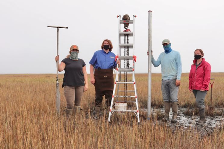
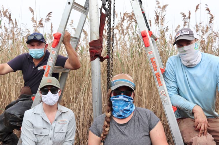
Left: (from left to right) Kristin Adams, Sean Yeats, David Steinmann & Georgie Grieb Right: Ramon Mejia, Brittany Moore, Kristin Adams & David Steinmann
Subaqueous Soil Sampling
What Are Subaqueous Soils?
Subaqueous soils are those soils that are submerged by water for more than 21 hours each day, or better known as the “bottom of the bay” or “bay muck”. In our region, there are two subaqueous soil surveys, the Barnegat Bay subaqueous survey, which was completed in 2018.
The Great Bay and Mullica River subaqueous survey is currently underway and to be completed and published on Web Soil Survey in October 2023. A customized pontoon boat is used to navigate to pre-determined sampling locations based on landform and bathymetry.
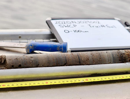
A subaqueous soil sample from Great Bay is split open for analysis on the boat—photo by Kristin Adams
Two different methods of sampling are used by NRCS Soil Scientists David Steinmann and Adam DeWolfe. The McCauley auger method is used in softer, finer textured soils that have more silt and organic matter, allowing for easier penetration with manpower. The auger is pushed into the soil for a 2-meter sample, and then split open for analysis on the boat. The other method is a vibracore, which uses a gas engine to vibrate a vibracore tube into the soil to help retrieve the sample. This is typically performed on sandy harder bottoms where the McCauley auger cannot penetrate. The vibracore is brought back to the lab for analysis at a later date.
While on site, collection of site data including bottom type, landform, water depth, presence of SAV (submerged aquatic vegetation), latitude/longitude, and water quality are completed. Collectively, this data is used to classify and map the subaqueous soils in the underwater environment, similar to terrestrial soil mapping.
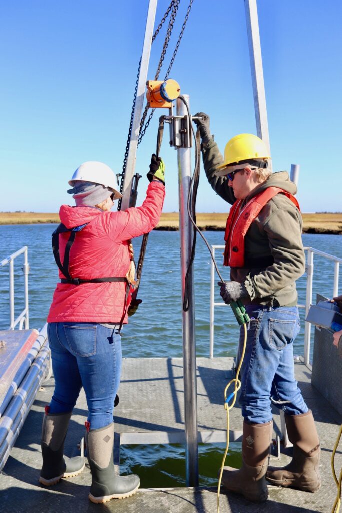
Kristin Adams & David Steinmann use the vibracore to retrieve a subaqueous sample in Great Bay—photo by Rachel Hammack
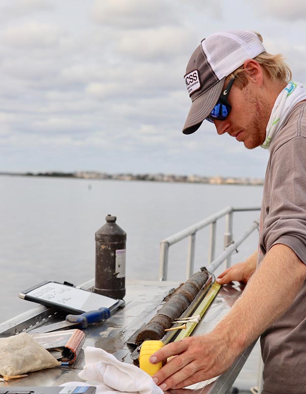
David Steinmann analyzes a subaqueous sample retrieved with the McCauley auger in the Great Bay—photo by Kristin Adams
Soil Sample Analysis
After the cores are taken, they are moved to a refrigerator unit until analysis to help preserve the integrity of the samples and slow down any chemical processes that will change the chemistry and composure of the soils.
Once the cores are cut open and split into two halves, they are divided into different soil horizons or layers based on physical (texture, color, % shell fragments, etc.) or chemical differences (pH, presence of sulfidic materials, etc.).
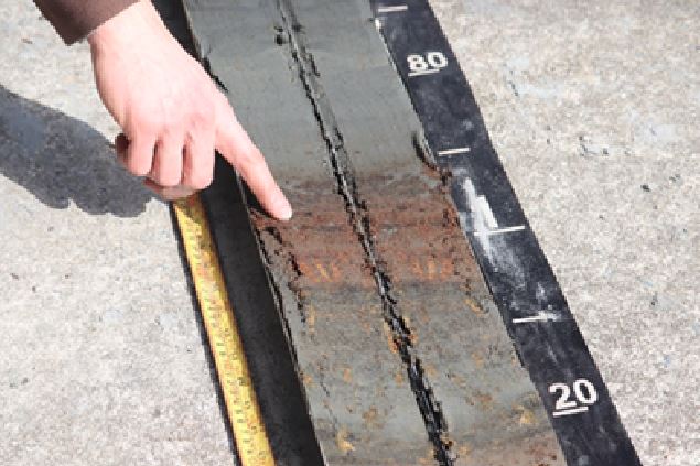
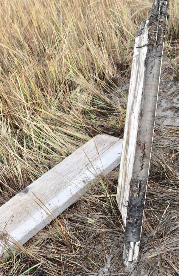
A subaqueous soil sample is being described by scientists; the orange/red portion identified shows an organic soil horizon – photo by Kristin Adams
In the photo on the left, the red/orange color of the soil is organic soil material, in this case plant roots developed in terrestrial tidal marsh that have been buried and preserved for perhaps hundreds of years. After the horizons are marked out, they are each measured for depth and assigned a color using the Munsell color chart.
Next, each horizon is given a USDA texture class based off the soil properties, such as a loamy fine sand or a silty clay loam as pictured here. Texture is determined using a ribbon test, if the sample is gritty or smooth, how well the sample holds together in a ball, how sticky it is and a fluidity test that all help scientists determine the percent of sand, silt, and clay in each sample.
Other analysis is performed including an odor test, pH test, degree or decomposition for organic horizons, and peroxide test, using 3% and 30% hydrogen peroxide solutions to determine the presence of sulfidic materials. The presence of shell fragments, roots, or any other buried materials are also noted in the description.
The two landforms observed are a wash over sand flat, which consists mostly of sandy material from the barrier island washed over and deposited directly behind the barrier island due to strong storm events, and submerged wave-cut platform/eroded marshes, which are associated with wave eroded marsh edges that typically have more silt and clay properties (muddy). These often have organic soil materials sequestered (buried) in the soil profile and are therefore a very important blue carbon sink.
After the analysis is complete and the core has been fully described, the characteristics are used to classify the soil and determine the soil series. The soils described and data collected will then be used to develop soil map units in the new subaqueous soil survey. Each soil series and mapping unit contains its own set of information, and once interpreted is available for viewing on Web Soil Survey
Coastal Zone Soil Interpretations
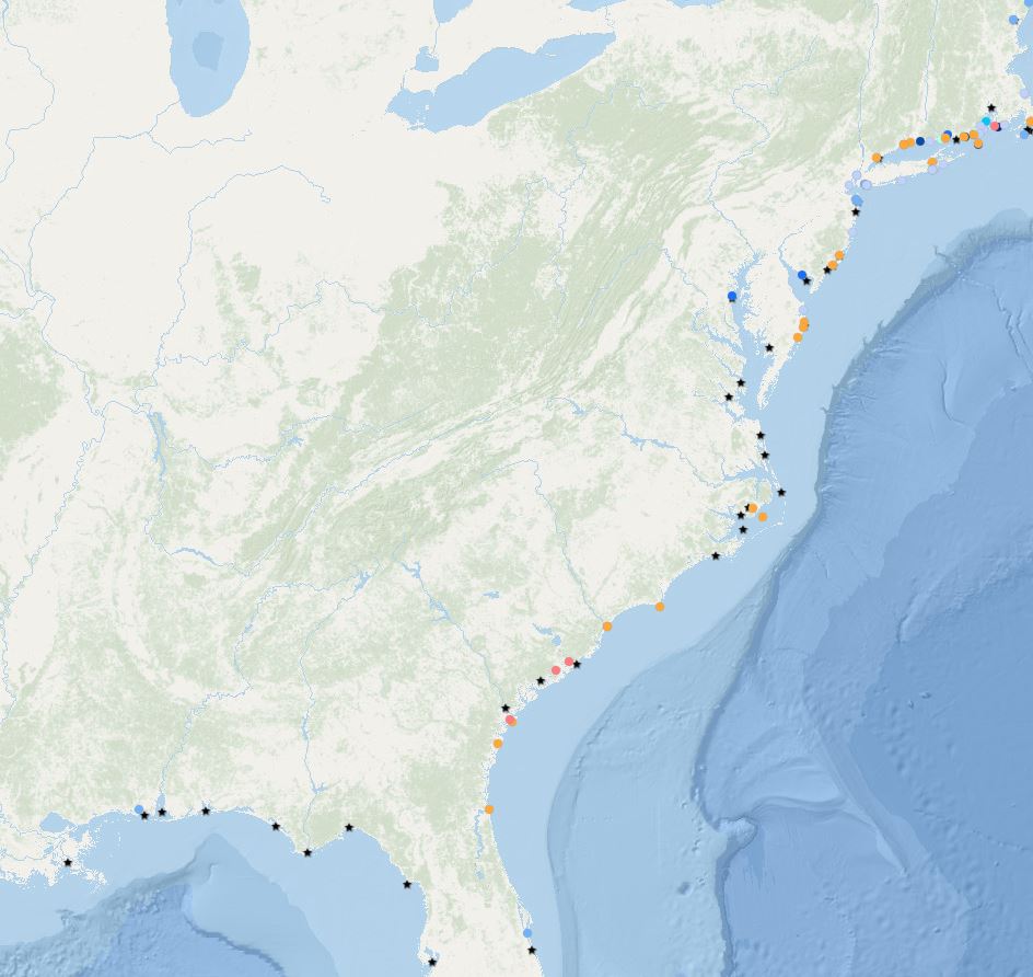
New Coastal Zone soil interpretations are available on Web Soil Survey for completed CZSS areas. These interpretations include suitability for Eastern Oyster Habitat Restoration, Eelgrass Restoration, Hard Clam Habitat, CMECS substrate classes, and Land Utilization of Dredged Materials, with many more coming soon.
A variety of partners, state and federal agencies, and universities can use this information for a variety of purposes from determining suitability for shellfish and SAV habitat, planning research and restoration efforts, managing dredging projects, determining valuable blue carbon sequestration areas, and many more applications.
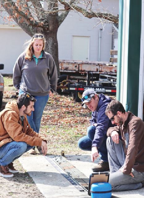
From left to right, Ben Hayden and Rachel Hammack (OCSCD) & David Steinmann and Adam DeWolfe (NRCS) determine the different horizons of the subaqueous soil sample – photo by Kristin Adams
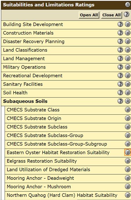
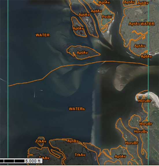
An example of a coastal zone soil survey map as available on Web Soil Survey and the many suitability and limitation ratings available to help interpret the map.